JUNKTRACK, a near real-time system to monitor, track and analyze spatio-temporal patterns of floating plastic pollutants (floating litter) in rivers, water bodies and coastal waters
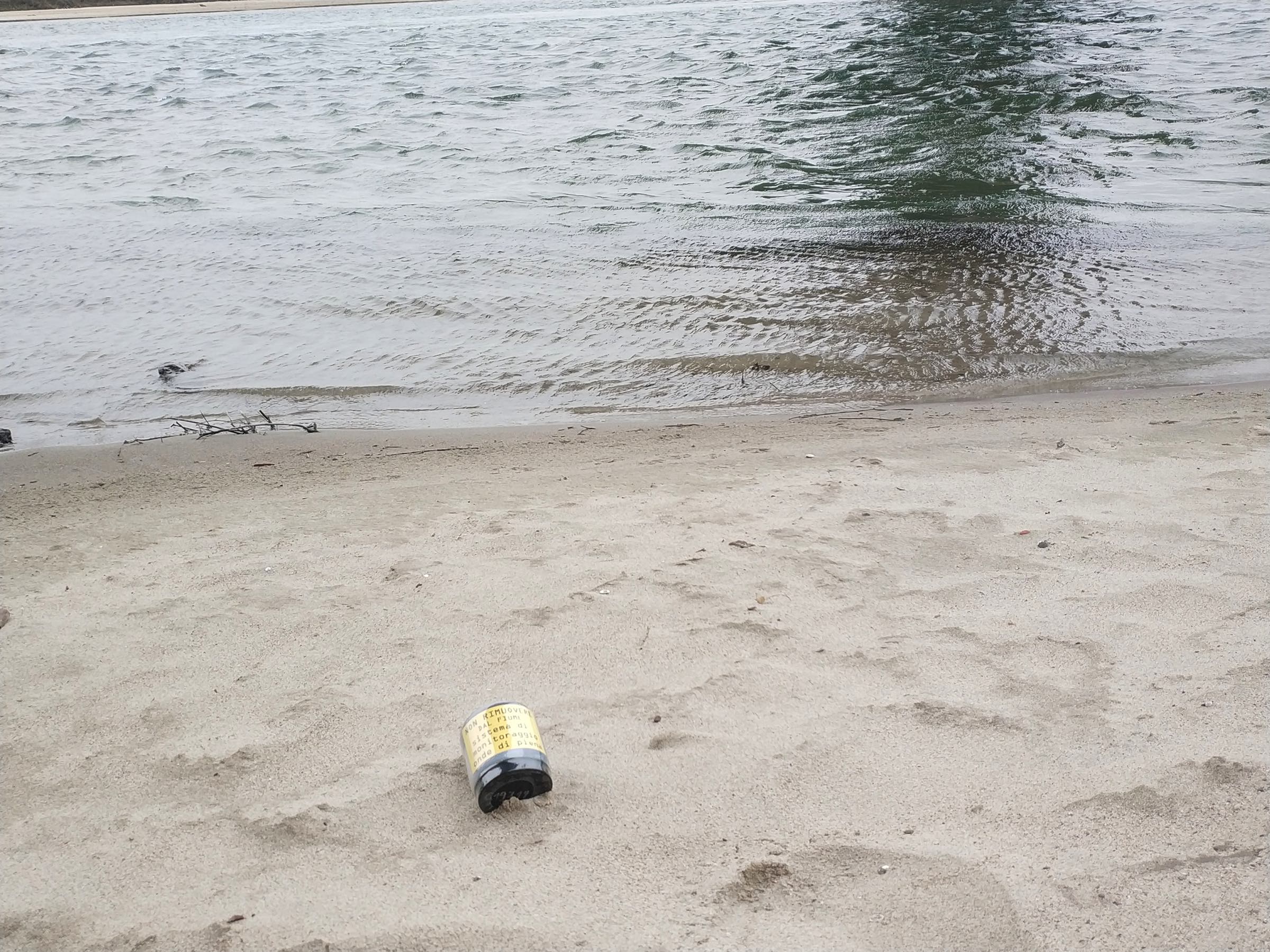
Nauta Scientific (Tech for Nature) and NaturalGIS (Open Source GIS) are partnering to present JUNKTRACK, an integrated system to monitor, track and analyze spatio-temporal patterns of floating plastic polluants (floating litter) in rivers, water bodies and costal waters. Junktrack allows researchers, environmental agencies, NGO's, etc. to better undestand the "life-cycle" of floating plastic polluants with near-realtime locations, not only for cientific reasons but also pratical ones, like for example better understanding where to focus cleaning and bonification efforts. Nauta and NaturalGIS are providing all the necessary know-how and skills to aid deploy Junktrack devices in your geographic region (all over the world) and install/configure the necessary software infrastructure. If you don't have the necessary infrastructure or don't have the know-how, then Nauta and NaturalGIS can provide them for you. The Junktrack system is made of the following components: Hardware GPS/GSM/Satellite devices, that can be fitted with batteries of different sizes depending on the type and size of "vessel" where the devices are stored. For a typical 1L plastic bottle, the GPS/Satellite devices can be suited with a battery that can transmit locations for up to 4 years, depending on the number of locations sent every day.

Software All used software is Open Source without licensing costs (purchase or maintenance). The software stack includes (among the others):
- a Desktop GIS software: QGIS, the world leading Open Source GIS
- an Enterprise RDBMS (Relational Database Management System): PostgreSQL, the world leading Open Source RDBMS, together with the PostGIS spatial extension
- a custom WebGIS platform, fully integrated with QGIS, to allow present data using web based interactive maps


Rivers and water bodies that are being monitored at the moment or will be soon:
- Po river, Norther Italy
- Adige river, Northern italy
- Tiber river, Central Italy
- Tagus river, Portugal
For more informations please contact: Nauta Scientific or NaturalGIS
In detail
JunkTrack is a system made up of position transmitters (transponders, trackers or locators) with a long operational autonomy (2 to 4 years),
housed inside plastic containers designed to simulate the behaviour of floating waste scattered in rivers.
The transmitters send their position, determined by the GPS/Galileo satellite network, several times a day, to a server.
The transmission of the position data is carried out via the cellular telephone network, which whenever possible adds the data concerning the cell through which the connection is made.
The server, the database for organising/storing the data, the routines that select the valid data, the progressive archive that is created and the spatial representation
of the devices locations along the weeks, are all part of the JunkTrack system and was developed as an original project by NAUTA scientific together with NaturalGIS.
The vessels where the GPS transmitters are housed, typically consists of sealed containers with PET casing that can be kept in a 'hibernation' condition using an external transducer.
As well as directly tracking waste floating in the current, if they are buried in the sediment of the embankments they can assess the erosion of the embankments themselves,
waking up, and sending an alarm, only when they are freed from the sands.
The transponders, with dive profiles varying from a few centimetres upwards, follow the flow of the water and the winds and tend to run aground and accumulate in
the shallowest areas and where the current is diminishing.
They tend to start up again when the water flow increases due to rainfall, the seasons and/or the regulation of artificial hydraulic weirs.

Monitoring these phenomena is important for assessing the floating load that is displaced by the waters and ends up in the sea, if not otherwise intercepted, at river mouths. Considering that the transmitters are free to move in the water following currents and airflows on the surface (according to current observations the behaviour is very much affected by the direction and strength of surface winds), and that often the river bed runs by its nature embedded in the plain, sometimes far from cellular coverage, the data flow from individual transmitters can be intermittent, either due to lack of coverage or due to a temporary buoyancy in the water that prevents the GPS position from being received correctly. Despite these two limiting factors, we are able to reconstruct the sequence of transmitter positions, identifying accumulation points and average speeds in the different sections.

Data representation
The collected data can be mapped in several different ways, using any of the capabilities of a well established GIS software like QGIS.
A common way to map GIS locations is aggregate (count) them using a reference
grid made of hexagonal plots. The colour of each plot is determined by the total number of locations within it.

The size of the hexagon is scaled as a function of the zoom at which it is displayed, in order to improve the granularity of the data. The choice of the hexagon as the cell shape derives from the more homogeneous distance between the centre and the periphery compared to the square. The GIS platforms behind Junktrack (both Desktop and Web) allows to switch on/off the data layers for each GPS, switch on/off the cells/plots with the data aggregatd, switch on/off the tracks with paths of single (or all) transmitters. The background map can be chosen from several sources, including satellite photography. The Junktrack system can process new data at any given interval (for example daily, overnight) and also automatically export auxiliary files using formats easily digestible by other GIS software and visualization tools like Google Earth, MS Excel (CSV, XLS), R, etc. The maps can display average speeds along the route, accumulation points, relationships with river regime, rainfall and all other relationships that can be identified on a geographical and temporal matrix.
For more informations please contact: Nauta Scientific or NaturalGIS